
Easterlies to Bring Isolated Rains Over Metro Manila and Parts of the Philippines
Warm, humid easterlies shape the next 24 hours
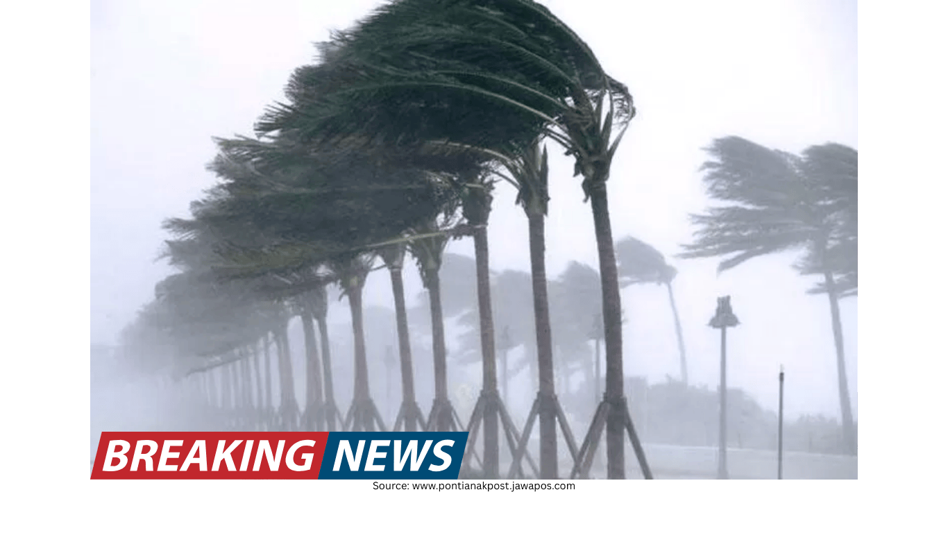
Metro Manila and many parts of the Philippines are expected to experience weather influenced by the easterlies—warm, humid air that typically comes from the east. In the next 24 hours, this weather pattern is forecast to bring partly cloudy to overcast skies with isolated rain showers or thunderstorms across the capital and the rest of the country.
This kind of setup often produces a familiar mix: long stretches of warm, humid conditions punctuated by brief bursts of rain or thunderstorm activity. The forecast emphasizes that rainfall will be isolated rather than widespread in Metro Manila and in many other areas under the influence of the easterlies.
No low-pressure area spotted
As of a 5 a.m. briefing, a weather specialist reported that the national weather agency had not spotted any low-pressure area forming either inside or outside the Philippine area of responsibility. The absence of a monitored low-pressure area suggests that, for now, the expected rains are being driven primarily by prevailing wind patterns and other atmospheric features rather than by a developing cyclone-type system.
Even without a low-pressure area, conditions can still turn unsettled at times—especially when warm, moisture-laden air supports the development of localized thunderstorms. For residents, that can mean sudden downpours that may be brief but intense, particularly in the afternoon or evening when thunderstorms commonly form.
Shear line affecting parts of Luzon
Alongside the easterlies, another weather system is influencing conditions in several provinces: the shear line, described as the convergence of hot and cold air. This feature has been affecting Cagayan, Isabela, Aurora, Quezon, and Rizal, where it is bringing cloudy skies with scattered rain showers and isolated thunderstorms.
Compared with the isolated rains expected in many other areas, the shear line’s impact is associated with more persistent cloudiness and a broader distribution of rainfall in the provinces it is affecting. Scattered rain showers and isolated thunderstorms can occur at different times of the day, and cloud cover may linger for longer periods.
Flash flood and landslide risk in shear line areas
For the provinces experiencing shear line conditions—Cagayan, Isabela, Aurora, Quezon, and Rizal—the forecast includes a specific hazard reminder: flash floods or landslides are possible due to moderate to at times heavy rains.
This warning underscores that while not every community will experience heavy rain at the same time, the potential exists for rainfall strong enough to trigger localized flooding or slope instability. Communities in low-lying areas and those near hillsides or mountainous terrain are typically more vulnerable when moderate to heavy rains occur, particularly if rain falls repeatedly over a short period.
Overcast skies and scattered rains in parts of the Visayas and the southwest
In addition to Metro Manila and the broader national outlook, the easterlies are also expected to bring overcast skies with scattered rains and thunderstorms over Western Visayas, Palawan, Basilan, Sulu, and Tawi-Tawi.
Overcast conditions can reduce daytime heating but may also signal sustained moisture in the atmosphere. With scattered rains and thunderstorms in the forecast, residents and travelers in these areas may see intermittent showers—sometimes accompanied by thunder—rather than continuous rainfall throughout the day.
Northeast monsoon continues in northern Luzon
In northern sections of the country, a different wind pattern remains in place. The northeast monsoon, locally known as “amihan,” is expected to prevail over the Ilocos Region, the Cordillera Administrative Region, and the rest of Cagayan Valley.
Under amihan conditions, these areas are forecast to have partly cloudy to cloudy skies with isolated light rains. This suggests generally manageable weather, though skies may be frequently clouded and light rain may occur at times.
What “isolated” versus “scattered” can mean on the ground
Forecast terms can be easy to gloss over, but they matter when planning a day. The outlook describes “isolated rain showers or thunderstorms” for Metro Manila and many other areas, while “scattered rain showers and isolated thunderstorms” are noted for provinces under the shear line, and “scattered rains and thunderstorms” for several areas including Western Visayas and parts of the southwest.
In practical terms, isolated rains suggest that not all locations will see rainfall, and those that do may experience it briefly. Scattered rains imply that more places are likely to get wet at some point, though not necessarily at the same time or for long durations. Overcast skies, meanwhile, can accompany either pattern and may increase the sense of a “rainy day” even if rainfall is intermittent.
Areas mentioned in the forecast
Metro Manila: Partly cloudy to overcast skies with isolated rain showers or thunderstorms within 24 hours due to easterlies.
Rest of the country (general outlook): Similar conditions—partly cloudy to overcast with isolated rain showers or thunderstorms—linked to humid, warm easterlies.
Shear line-affected provinces: Cagayan, Isabela, Aurora, Quezon, and Rizal to have cloudy skies with scattered rain showers and isolated thunderstorms; flash floods or landslides are possible due to moderate to at times heavy rains.
Areas with overcast skies and scattered rains/thunderstorms due to easterlies: Western Visayas, Palawan, Basilan, Sulu, and Tawi-Tawi.
Amihan areas: Ilocos Region, Cordillera Administrative Region, and the rest of Cagayan Valley to experience partly cloudy to cloudy skies with isolated light rains.
Planning around a humid, thunderstorm-prone pattern
With warm, humid air influencing much of the country, the day-to-day experience in many areas can include sticky conditions and the possibility of sudden rain. In Metro Manila, the forecast points to isolated showers or thunderstorms rather than continuous rain, which can make weather feel changeable: bright conditions can quickly give way to a downpour, then return to warm, humid air afterward.
In provinces affected by the shear line, the mention of moderate to at times heavy rains elevates the need for caution. Cloudy skies and scattered rain showers can persist, and thunderstorms may develop. Where heavier rain occurs, the risk of flash flooding or landslides becomes a key concern.
A snapshot of the current weather drivers
The forecast highlights three main drivers shaping conditions across different parts of the Philippines:
Easterlies: Warm, humid air bringing partly cloudy to overcast skies and isolated rain showers or thunderstorms over Metro Manila and many other areas, and overcast skies with scattered rains and thunderstorms over Western Visayas, Palawan, Basilan, Sulu, and Tawi-Tawi.
Shear line: A convergence of hot and cold air affecting Cagayan, Isabela, Aurora, Quezon, and Rizal, producing cloudy skies with scattered rain showers and isolated thunderstorms, with possible flash floods or landslides due to moderate to at times heavy rains.
Northeast monsoon (amihan): Prevailing over Ilocos Region, the Cordillera Administrative Region, and the rest of Cagayan Valley, bringing partly cloudy to cloudy skies with isolated light rains.
Bottom line
Over the next 24 hours, humid, warm easterlies are expected to keep Metro Manila and much of the Philippines under partly cloudy to overcast skies with isolated rain showers or thunderstorms. No low-pressure area has been spotted forming inside or outside the Philippine area of responsibility, pointing to localized rain events rather than a developing cyclone system.
At the same time, a shear line continues to affect Cagayan, Isabela, Aurora, Quezon, and Rizal, where scattered rain showers and isolated thunderstorms may bring moderate to at times heavy rains—raising the possibility of flash floods or landslides. Elsewhere, the northeast monsoon remains in place over parts of northern Luzon, with isolated light rains expected in the Ilocos Region, the Cordillera Administrative Region, and the rest of Cagayan Valley.